
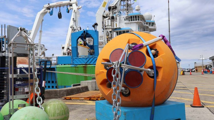
CSIRO’s research vessel (RV) Investigator is heading into the heart of the Antarctic Circumpolar Current to investigate why the planet’s strongest current that helps keep the Antarctic frozen is leaking warm water into the polar seas.
The science team led by Australia’s national science agency, CSIRO, and the Australian Antarctic Program Partnership is seeking to understand how currents in the Southern Ocean contribute to melting Antarctic ice shelves.
Voyage chief scientist CSIRO’s Dr Benoit Legresy said the Antarctic Circumpolar Current plays an important role in understanding the impact ice melt has on sea rise.
“The Antarctic Circumpolar Current flows around the icy continent from west to east and acts as our safety belt so that the warm water doesn’t reach the Antarctic and melt the ice,” Dr Legresy said.
“But the Antarctic Circumpolar Current generates the whirling eddies and finer scale dynamics that we’re trying to understand, and which are the prime suspect for warm water seeping towards the pole.
“There are five ‘eddy heat flux gates’, or hot spots, identified around the Antarctic Circle and they’re acting as a gateway for the heat to go south. We’re going to track down those small features that we think explain the heat seeping into polar waters.”
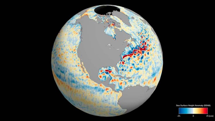
The voyage will be the first time scientists validate imagery of the Southern Ocean taken by the new Surface Water and Ocean Topography (SWOT) satellite, jointly developed by NASA and the French space agency Centre National d’Études Spatiales (CNES).
While the ship measures the properties of the ocean inside the current, the satellite will measure the height of the ocean surface from space. The SWOT satellite is revolutionising how scientists observe Earth’s water elevation with 2km pixel, high-definition imagery.
Passing over the Southern Ocean, it will take the highest resolution ocean topography to date of the Southern Ocean and the Antarctic Circumpolar Current.
These small-scale ocean features contribute to redistributing heat and carbon and energy in the ocean, major components in global climate change.
Dr Rosemary Morrow, CNES SWOT Ocean Lead, said SWOT was a “breakthrough satellite mission”.
“Our first images already show the incredible two-dimensional structure of ocean eddies and fronts, and how they are stretched and strained by the turbulent ocean,” Dr Morrow said.
“These small-scale ocean dynamics are key in stirring heat and carbon across the ocean, but also in pumping them deep into the ocean interior.
“The new SWOT observations, combined with measurements taken on RV Investigator, will usher in a new era, by extending our knowledge from one-dimensional sections to the full 3-D ocean variations.”
The voyage continues a tradition of highly collaborative, international science concentrated on the Antarctic and the preservation of the icy continent.
Principal investigators relying on data collected from the voyage as part of their ongoing research include scientists from CSIRO, the University of Tasmania, Caltech (the California Institute of Technology), Woods Hole Oceanographic Institution, the University of Washington and the Laboratoire d’Etudes en Géophysique et Océanographie Spatiales.
The voyage departs Hobart this week and returns 20 December.
This research is supported by a grant of sea time on RV Investigator from the CSIRO Marine National Facility which is supported by the Australian Government’s National Collaborative Research Infrastructure Strategy (NCRIS).

