
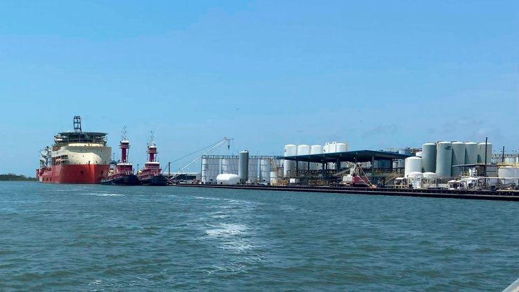
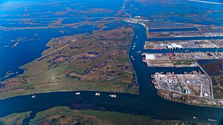
Port Fourchon in Lafourche Parish serves 90% of the Gulf of Mexico’s deepwater oil and gas activities, which is why the U.S. Naval Research Laboratory has invested $25 million in Louisiana State University (LSU) to create a digital dome protecting Port Fourchon and the Louisiana Offshore Oil Port, the nation’s only offshore deepwater port, from cybersecurity threats. More than 1.5 million barrels of crude oil are transported by pipelines through the port per day and about 1,200 trucks travel in and out of the port as well each day.
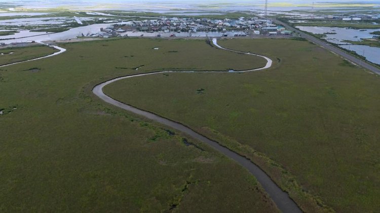
A long, thin strip of sandy beach stretches along the southern perimeter of the port, buffering it from the northern Gulf of Mexico and the threat of hurricanes, storm surge, and flooding. However, every year, the shoreline retreats by about 30 to 50 feet, creeping closer to the port, which houses more than 250 companies. The beach that lies to the south of Port Fourchon loses more land each year from sea level rise, erosion, and subsidence, or sinking, than any other place in the U.S.
Dredging, or digging up, sand and sediment from the sea floor and sand bars and transporting it to rebuild and reinforce beaches, such as the one that protects Port Fourchon, as well as sand dunes, barrier islands, and marshes, is one of the main strategies used to combat coastal land loss in Louisiana. However, it is a costly endeavor. For example, the state spent more than $70 million to dredge and transport 3.3 million cubic yards of sand by barge and pumped it through a pipeline to reinforce the Caminada Headland, another undeveloped beach significantly impacted by erosion, that also protects Port Fourchon from storms.
The sediment budget, or the amount of sand and sediment available for large-scale dredging projects like this, is finite. Additionally, hurricanes can displace sand and sediment, which makes dredging and renourishment projects even more challenging. That’s why Xu’s expertise in computationally modeling sediment transport is vital.
LSU faculty recently met with the stakeholders in Port Fourchon to get an up-close look at the port and discuss ways to collaborate on coastal and environmental projects.
Kevin Xu, LSU Coastal Studies Institute Interim Director, and his co-authors said in a recent paper published in Coastal Engineering:
“Understanding the drivers and processes responsible for coastal geomorphic change is central to estimating long-term sediment budgets—an important facet of resiliency in the context of sea-level rise and a changing climate—and coastal restoration.”
Port Fourchon and the Caminada Headland were just east of Hurricane Gustav’s track, which Xu and other experts say is the most dangerous place to be during a hurricane. During Hurricane Gustav, sand from the beach and offshore was pushed up over the dune and deposited in the marsh by the port.
The effect is called an over-wash deposit. It happens naturally, but the magnitude of the over-wash deposit south of the Port Fourchon area [from Hurricane Gustav] was massive. Due to the counterclockwise wind movement of hurricanes in the northern hemisphere, the strongest wind energy and force hits the areas to the east or right of the track line of a hurricane.
Xu said:
“The spatial pattern is very clear: tens of kilometers just east of the track line, at that location, you will experience the strongest wind, tallest waves, and biggest sediment deposition. It’s the most damaging and destructive location.”
The experts have been funded over the past seven years to study the dredge pits from where sand is dug and transported to rebuild dunes and beaches, such as the ones that protect Port Fourchon.
Ship Shoal is a large sandy area located off Louisiana’s south-central coast, which is estimated to have 1.2 billion cubic meters of high-quality quartz sand. Tens of millions of cubic meters of this high-quality sand has already been dredged from Ship Shoal to restore the Caminada Headland. Ship Shoal dredge pits fill back up with mud and sand under the impact from the Mississippi and Atchafalaya rivers, wind-driven currents, storm waves, and tides. LSU researchers continue to study this dynamic place that is important to coastal restoration as well as the environmental impacts of the dredge pit.
Xu said:
“What we found is that those dredge pits can potentially impact water quality.”
Other LSU researchers have shown that hypoxic conditions in the Gulf of Mexico do not bode well for marine life including fish, shrimp, and crabs that fuel the seafood industry.
In addition to the ecological impact, the scientists also studied how the dredge pit affects the oil and gas pipelines. They found that the walls of the dredge pits are fairly stable. It is unlikely that the pit will collapse and affect the pipeline in the short term, especially with the 1,000-foot buffering distance set by the Bureau of Ocean & Energy Management for dredging near the pipeline.
Resource managers at the state’s Coastal Protection and Restoration Authority, or CPRA, rely on academic research findings to maximize the benefits of projects while minimizing negative impacts. In light of continued subsidence, sea level rise, and stronger storms, resource managers apply LSU research toward developing sustainable solutions.

