1.8 C
New York
Home Blog Page 487

SOHAR signs MoU to supply UTAS Suhar with new AI lab

0

SOHAR Port and Freezone signed a Memorandum of Understanding (MOU) with the University of Technology and Applied Sciences (UTAS) in Suhar which will see the development of an AI Lab on campus.

Signed by HE. Dr. Saeed bin Hamad Al Rubaie, Vice Chancellor of the University Technology and Applied Sciences and Omar bin Hamood Al Mahrizi, Deputy CEO SOHAR Port and CEO of the Freezone, the agreement will see SOHAR supply the necessary equipment to develop artificial intelligent technology capabilities to benefit the community as well as improve efficiency within the port and freezone.  

SOHAR has strategically invested in new technologies to capitalize on its beneficial location and abundant resources to maintain its competitive advantage and drive growth in Oman’s industrial sectors. The use of cutting-edge technology throughout the complex will unlock new opportunities for tenants, maximize productivity and assist in the smooth running of the port and freezone as it continues to expand.

During the signing, HE. Dr. Said Al Rubaie said:

“This partnership feeds directly into our goals at  the University which aim to identify the right private sector partners and bridge our educational output with the technical requirements on the job. The upcoming lab in the Suhar is a testament of our advancement, as we continue to shape the future of education. By integrating AI into our academic curricular, we will be creating a generation with the right skillsets and knowledge that will contiiniously innovate. Furthermore, we are laying the foundation to develop new disciplines that will allow us to keep up with the rapid developments we see in technology, machine learning and robotics.”

Omar Al Mahrizi, DCEO of Sohar Port and CEO of the Freezone, said:

“The MOU with UTAS provides SOHAR with an outlet for talented students to develop AI applications and initiatives with a real-world purpose in mind. Ultimately, the adoption of technology will benefit the wider community, industries across the country and have a wide-reaching impact on the lives of people in Oman by creating a culture of innovation which will last long into the future. As we continue to expand, we will need intelligent solutions to increase efficiency and support evolving supply chains.” 

The collaboration between SOHAR and UTAS will build national capacities in the field of AI and technology, directly benefiting students as well as faculty, tehcnicians and researchers.  This will also bring the educational sector together with the manufacturing and industrial sector to nuture a workforce that will contribute in building a knowledge based society.

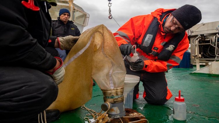
SOHAR already uses AI in its maintenance and observation routines, becoming the first port in Oman to adopt drone technology as part of the Port’s monitoring system. Underwater drones equipped with cameras also provide real-time observation and analysis of the infrastructure, security and environmental situation across the port by sending images to the quay where problems can be solved quickly and up-to-the-minute status reports can be compiled. The use of artificial intelligence has proven successful in predicting future maintenance through lifecycle reports and capable of reaching areas humans cannot while offering a new perspective of the entire complex.


Scandinavia’s largest port to start operating hybrid sludge-collecting vessels

0

During the second quarter of 2022 the service ship Northern Skagerrak will be converted to hybrid operation. It will run mostly using electric power although there will also be an auxiliary engine that runs on the renewable fuel HVO.

Northern Skagerrak will collect oily engine room waste, known as sludge, from ships arriving at the Port of Gothenburg. The Gothenburg Port Authority procured the service from Northern Energy & Supply and the service ship will begin operating during the second quarter of 2022. The conversion will save 680 tonnes of carbon dioxide.

When the invitation to tender for sludge collection was issued, the Port of Gothenburg climate objectives were used as a starting point in the evaluation model. Carbon emission mitigation was one of the quality criteria applied when assessing potential service providers. Following collation and evaluation, the Northern Energy & Supply fossil-free solution proved to be the best option.

Erik Waller, Deputy Harbour Master at the Gothenburg Port Authority, said:

“Our aim at the Gothenburg Port Authority is to reduce carbon emissions at the port by 70% by 2030. Northern Skagerrak will serve around 6,000 incoming ships each year and the conversion to hybrid operation will be a significant step in the right direction.”

All ports in Sweden are obliged to receive sludge from ships arriving at the port. During operation, the vessels accumulate sludge, which is essentially wastewater containing a mixture of oil residue, cleaning agents, and solvents. The ships leave the wastewater to the port, then it is transported to a purification plant where oil and heavy-metal contaminants are separated from the water.

Chilean scientists study climate change at ‘end of the world’

0

A recent expedition, which was delayed by a year due to the coronavirus pandemic, sought to investigate harmful organisms and how they are impacting climate change.

Chile’s Magallanes region—on the southern tip of South America where the Atlantic and Pacific oceans meet—is known as the “end of the world” and extends from Punta Arenas through the Magallanes Strait to the Beagle Channel.

Sailing through peak-lined straits past glaciers and soaring birds, the scientists on board the oceanographic research vessel Cabo de Hornos had their focus trained on the water, which has lower levels of acidity, salt and calcium than other seas and oceans, especially in their shallowest parts.

Scientists believe the conditions found in the water will appear in other parts of the world in the coming decades, as the impact of climate change mounts.

Jose Luis Iriarte, who headed the expedition, told AFP:

“The regional plans for mitigation and adaptation to climate change are out of date with respect to what is happening in the environment. The environment is changing quicker than we as a society are responding to it.”

The scientific mission paid special attention to the “red tides”—harmful algal blooms that can turn the sea red.

They were first recorded in the Magallanes region half a century ago and have since been responsible for the deaths of 23 people and poisoned more than 200.

This area is also affected by melting glaciers, a product of global warming.

Iriarte said:

“We don’t know how these organisms and particularly microorganisms will respond to these effects.”

The expedition stopped at 14 places, each time taking water samples at different levels up to a depth of 200 meters using a piece of equipment called a rosette.

Another piece of equipment was used to collect soil samples, sometimes at a depth of more than 300 meters. The scientists also combed the shores for algae and molluscs.

From the highest point on the boat, marine biologist Rodrigo Hucke, one of 19 scientists on the expedition, spent hours scanning the surface of the water.

Spotting a far off whale, he would give the signal and then jump into a small motorboat to try to get as close as possible to the huge mammal in a bid to collect its faeces, with the aim of looking for changes to its diet.

Hucke says there has been a historical lack of action by governments when it comes to the oceans, which cover 70 percent of the planet’s surface.

He hopes the next UN Climate Change Conference—COP27 in Egypt—will mark a true global transformation in how the oceans are managed.

Hucke said:

“All of this needs to change in 2022 and there needs to be a concrete decision in advancing toward profound policies of change in how us humans do things.”

He is worried that this region could one day become “one of the last bastions of biodiversity on Earth.”

Source: AFP 

Tallink Grupp’s Megastar to go for first regular dry-docking in January 2022

0

Tallink Grupp’s Tallinn-Helsinki route shuttle vessel Megastar will go for its first regular dry-docking since the vessel first started operating on the route in January 2017 to Naantali shipyard in Finland in January 2022. 

During the docking the vessel will go through the standard and required class renewal process, maintenance of underwater hull and several of the ship’s systems, valves, pumps, etc and installation of the high-voltage shore power systems in order for the vessel to be connected to the shore power systems during longer port-stays.  In addition to technical maintenance and upgrades, passenger areas of the vessel will also be updated and refreshed. 

During the vessel’s dry-docking period, capacity on the Tallinn-Helsinki route will be supplemented by the company’s cruise vessel Baltic Queen, which will operate on the route daily according to the following schedule: 

  • Tuesday, 11 January 2022: depart Tallinn at 13.30 and arrive in Helsinki at 16.30,
    depart Helsinki at 21.30 and arrive in Tallinn at 00.30
  • Wednesday, 12 January  – Friday, 14 January 2022: depart Tallinn at 07.30 and arrive in Helsinki at 10.30,
    depart Helsinki at 16.30 and arrive in Tallinn at 19.30
  • Sunday, 16 January 2022 –  depart Tallinn at 18.30 and arrive in Helsinki at 21:30
    depart Helsinki at 22.30 and arrive in Tallinn at 01.30

Baltic Queen will operate between Tallinn Old City Harbour Terminal D and Länsiterminaali 2, similarly to Megastar. Megastar will return to the Tallinn-Helsinki route according to its normal schedule on Monday, 17 January 2022. 

During the docking period, the company’s other shuttle vessel Star will continue to operate according to its normal schedule.

Crew that has sailed the seven seas to take brand-new Viking Glory to Finland

0

The trip will go via the Suez Canal and the Strait of Gibraltar and take nearly five weeks.

Viking Line’s new flagship, the passenger ship Viking Glory, began its journey today from Xiamen, China, to its home port of Turku. The vessel sails under a Finnish flag, and the route will be via many of the world’s best-known waterways. After crossing the Indian Ocean, Viking Glory will sail to the Mediterranean Sea via the Suez Canal and after passing Gibraltar will head north and reach the Baltic Sea via the Danish straits. The vessel’s cruising speed is an average of 16 knots, and the journey home will take nearly five weeks.

A crew of 40 people under the command of Captain Ulf Lindroos climbed aboard Viking Glory in China. Sub-contractors will also board the vessel en route.

Ulf Lindroos, Viking Glory’s captain, says:

“We have eagerly waited to take Glory home. The most eager of us already had our bags packed several weeks before the departure and brought our things to the shipyard for storage. There were also people interested in sailing with us, but we could not take them on board since we will work on building and finishing things during the course of the journey as well.”

Viking Glory was launched in January 2021 at XSI’s shipyard in Xiamen, China. By then, the vessel had already completed two demanding sea trials, to check to make sure the vessel’s systems function under actual conditions. The first sea trial in June included a test run of ABB’s Azipod propulsion system, testing of the vessel’s manoeuvrability and confirmation that the lifeboats and fire alarm system work. The second sea trial included checks of all machinery systems with focus on endurance. At the same time, the vessel’s noise and vibration levels were tested.

Norway has been given a floating ocean laboratory

0

Marine research: just off the small island of Munkholmen, outside  the city Trondheim, the first of two observation buoys is now installed to collect data from the fjord. With a diameter of five meters and a yellow colour, the buoy is easy to spot from land. The buoys will be powered primarily by wind and solar, and don’t need to be permanently manned.

SINTEF researcher Emlyn Davies says:

“It is probably an understatement to call this a buoy. A floating laboratory would probably be a better description.”

He is a marine scientist and has helped to develop some of the equipment that will be undertaking continuous measurements of marine environmental data.  The research buoy will be important for testing ocean sensor technology, the education of future marine scientists, and establishing long-term data on the status of the environment in the fjord. 

The information from the buoys will be used for increasing environmental understanding and for developing and updating models. Ocean models can forecast things like current conditions and algae blooms, but more knowledge is needed in order to further develop them. 

The floating laboratory will also contribute to making local environmental policy more knowledge-based. 

The second buoy, which has a diameter of about two metres, will be located outside Ingdalen in the municipality of Orkland. 

Both buoys are part of OceanLab, which will host one of the world’s most advanced array of data collection platforms for marine research. 

According to Davies, OceanLab is a new and state-of-the-art national research infrastructure that is being established in Trondheim. It is a collaborative venture between SINTEF and NTNU, funded by the Research Council of Norway. OceanLab will contribute to research on underwater robotics, aquaculture, autonomous shipping and environmental research. The observation buoys are particularly important for increasing understanding of the environment in the fjord. 

The data collected will be made available in real time on a digital platform for anyone who is interested. 

Davies says:

“As we gradually develop new ways of utilising resources in the ocean, we also have an increasing need to collect data. This is important in order to develop good ocean models that can predict the impact of developments – something which is also one of the goals of the UN Ocean Decade. This will provide us with more knowledge about the consequences of what we do. One example of this is the increasing interest in harvesting more of the smallest organisms found in the sea, such as Calanus finmarchius and krill. The data we collect will provide a better understanding of how these affect the environment.”

The buoy off Munkholmen will collect data on everything that happens close to it, such as the weather, waves, current and temperature, and it is specially equipped to monitor underwater life. 

It will have a range of features, including particle imaging, acoustic communication and a plug-and-play interface for customised sensors. In practice, this means that researchers can add and remove sensors as required. The floating lab will also have equipment that can take photos of organisms that are invisible to the human eye, such as phytoplankton. 

Davies says:

“By looking at the kind of plankton here, what it looks like and how it changes during the course of the season, we will be able to see, for example, how the River Nid affects the ecosystem in the fjord. With climate change we are seeing more extreme weather with heavy rain that carries water from the land and out to the ocean. When sediment enters the fjord it blocks the light. One of the effects is that it prevents algae from growing, which in turn results in a reduction in the food available for organisms and lowers oxygen production. To understand these kinds of changes and their consequences, we need to collect environmental data over the longer-term.”

One of the most advanced instruments on the buoy is called CytoSub. This equipment creates on-site images by lowering an instrument called a flow cytometer, which produces microscope images and fluorescence signatures of particles and plankton right down to nano-level.  

The reason is that phytoplankton are critical organisms for ocean ecosystems. Phytoplankton produce about 50 per cent of the world’s oxygen. They also harness energy from sunlight which scientists can measure by using light sensors. The plankton is also a primary source of food that in turn is eaten by larger organisms. 

The position of the buoy at Munkholmen has been calculated by using a 3D model developed by SINTEF called SINMOD. This model system connects and simulates physical and biological processes in the ocean. According to SINMOD the selected point is representative of much of the fjord. 

Davies says:

“Even if the data is only collected in one place, what is happening in Trondheim Fjord may be representative of ocean conditions elsewhere in the world. For example, if the sediment darkens the water and has an impact on nature, then that knowledge is transferable to other coastal areas.”

The two buoys will also facilitate the development of sensor technology. 

Davies says:

“They will serve as a platform that can support faster technology development and prototyping of new sensors, as well as comparisons of different sensors that measure the same thing in different ways. Here we can test new technology while it is being developed.”

Testing this type of technology is often both costly and time-consuming, but here the researchers and tech companies will only be a few hundred meters away. 

Davies says:

“We can get here in minutes, plug in what we want to test and obtain the data very quickly.”

SINTEF Ocean has acquired the buoy from the British company Hydrosphere, which has supplied the buoy in accordance with a design developed by Mobilis in France. They have developed the buoy specifically for OceanLab. 

John Caskey of Hydrosphere says:

“This is the largest buoy we have developed so far. It has four chambers for sensors and measuring equipment and it has also been adapted for power generation using solar cells, wind cells and spare fuel cells so that it is self-sufficient in electricity – even in winter.” 

Partners launch project to develop low pressure solutions for CO2 ship transport

0

The CETO (CO2 Efficient Transport via Ocean) JIP will carry out the technology qualification of a low-pressure ship design and identify solutions to scale CO2 transportation volume, while reducing the associated risks, to support the development of opportunities in CCS. CETO is funded by the project partners and GASSNOVA through the CLIMIT programme and is expected to be completed in 2023.

Carbon capture and storage (CCS) will be a key technology if the world is to meet the goals of the Paris and Glasgow agreements. Although the technologies and the industry are very much still emerging, a possible challenge is connecting capture sources to facilities for use or storage sites, especially where pipelines are not an option. As a result, CO2 transport ship technology will be needed if large quantities are to be safely transported at costs that are commercially viable. Today, most transport of CO2 via ship takes place at small scale and at medium pressure (15 bar at -28ºC), limiting the possibilities of scaling up to meet future growth in CCS.

To transport CO2 safely and efficiently at industrial scale by ship, low pressure transport systems (approx. 7 bar at -49ºC) are a potential solution, as this enables much larger tank volumes, cargo capacities and therefore reduced transportation costs. However, the industry currently has little practical experience with the transport of liquid CO2 (LCO2) under these conditions.

The JIP looks to build experience in low pressure transport and fill a vital knowledge gap, by examining the fundamentals of a low-pressure CO2 transport chain, including:

  • A LCO2 ship design, with low pressure tank and cargo handling system
  • Material choice and testing
  • Medium scale testing and simulation of cargo handling
  • Conditioning and liquefaction
  • Testing LCO2 behaviour at low pressure

Johan Petter Tutturen, VP, Special Projects – Gas at DNV, said:

“As an important part of tackling the climate crisis, reducing costs across the whole CCS value chain is essential. Low pressure CO2 ship designs are a potentially important piece of the chain, but they need to be reliable and meet accepted safety standards. That is why we are very pleased to be working together with this strong consortium of CCS stakeholders to identify the technical risks and challenges to enable safe and economical operations going forward.”

Syrie Crouch, VP Carbon Capture Utilisation and Storage at Shell, said:

“As we build a wider global CCUS (carbon capture, utilisation and storage) network that connects CO2 emitters with sinks, it is critical that we are able to ship CO2 safely, economically and at scale. Ensuring these CO2 transport vessels and their associated loading/unloading facilities are standardised to enable interconnectivity between capture and storage facilities will be key to success. Shell looks forward to working with the JIP on the next generation of CO2 ships to deliver this vision.”

Elisabeth Birkeland, VP for Carbon capture and storage solutions in Equinor, says:

“Equinor believes that low pressure ship transport is an interesting way to scale up CO2 transport solutions, but we need to make sure the technical risks are reduced to an acceptable level. That is why this project is important.”

Bruno Pahlawan, VP R&D Line Sustainability, TotalEnergies, said:

“We are very pleased to be part of this initiative, alongside our partners, to develop low pressure CO2 ship carriers. This future technology will open the door to the large-scale transport of CO2, which is an essential element for the upscaling of the CCS industry. It is fully in line with TotalEnergies’ ambition to get to net-zero emissions by 2050 together with society, for its global business across its production and energy products used by its customers.”

The CETO JIP is named after Ceto, who is a primordial sea goddess in Greek mythology, and builds on an earlier project carried out by the partners that investigated the technology gaps and identified qualification activities to demonstrate that the technologies offer the required levels of operational safety and reliability.

Glaciers collapse could trigger global floods and swallow islands

0

Adding 65cm to global sea levels would be coastline-changing amounts. For context, there’s been around 20cm of sea-level rise since 1900, an amount that is already forcing coastal communities out of their homes and exacerbating environmental problems such as flooding, saltwater contamination and habitat loss.

But the worry is that Thwaites, sometimes called the “doomsday glacier” because of its keystone role in the region, might not be the only glacier to go. Were it to empty into the ocean, it could trigger a regional chain reaction and drag other nearby glaciers in with it, which would mean several meters of sea-level rise. That’s because the glaciers in West Antarctica are thought to be vulnerable to a mechanism called Marine Ice Cliff Instability or MICI, where retreating ice exposes increasingly tall, unstable ice cliffs that collapse into the ocean.

A sea level rise of several meters would inundate many of the world’s major cities—including Shanghai, New York, Miami, Tokyo and Mumbai. It would also cover huge swathes of land in coastal regions and largely swallow up low-lying island nations like Kiribati, Tuvalu and the Maldives.

Thwaites is a frozen river of ice approximately the size of Great Britain. It already contributes around 4% of the global sea-level rise. Since 2000, the glacier has had a net loss of more than 1000 billion tons of ice and this has increased steadily over the last three decades. The speed of its flow has doubled in 30 years, meaning twice as much ice is being spewed into the ocean as in the 1990s.

Thwaites glacier, the widest in the world at 80 miles wide, is held back by a floating platform of ice called an ice shelf, which restrains the glacier and makes it flow less quickly. But scientists have just confirmed that this ice shelf is becoming rapidly destabilized. The eastern ice shelf now has cracks criss-crossing its surface, and could collapse within ten years, according to Erin Pettit, a glaciologist at Oregon State University.

This work supports research published in 2020 which also noted the development of cracks and crevasses on the Thwaites ice shelf. These indicate that it is being structurally weakened. This damage can have a reinforcing feedback effect because cracking and fracturing can promote further weakening, priming the ice shelf for disintegration.

If Thwaites’ ice shelf did collapse, it would spell the beginning of the end for the glacier. Without its ice shelf, Thwaites glacier would discharge all its ice into the ocean over the following decades to centuries.

The ice shelf—which can be thought of as the floating extension of Thwaites glacier—is one of several that scientists are watching closely in the Amundsen Sea Basin, West Antarctica. Several ice shelves that hold back glaciers there, including Thwaites and its next-door neighbor, the Pine Island glacier, are being eroded by rising ocean temperatures.

Warmer ocean water is able to undercut these floating ice shelves, driving melting from below that can thin the ice and weaken it, allowing the cracks and fractures that have been observed at the surface to develop. This ocean-driven melting at the bottom of the ice shelf also pushes the anchoring point where the ice meets the seabed backwards. Because the seabed slopes downwards in the Amundsen Sea, that could eventually trigger a shift as the glaciers lose their footing and retreat rapidly.

Ultimately, if the ice shelves retreat, it means there is less holding the West Antarctic glaciers back—allowing them to accelerate and add more to global sea levels.

However, scientists are still getting to grips with MICI and questions remain about the future of West Antarctic glaciers. While the collapse of Thwaites certainly could trigger a wholesale collapse event, not everyone believes this will happen.

Other work suggests that the destabilization of the Thwaites ice shelf and glacier may not lead to the kind of catastrophic outcomes that some fear. Sea ice and chunks of ice that break away from the collapsing ice shelf and glacier might have a similar restraining effect to the intact ice shelf, nipping the chain-reaction in the bud and preventing the sustained collapse of the entire West Antarctic ice sheet.

But while uncertainty remains about exactly what will happen in West Antarctica, one thing is for sure—the retreating Thwaites glacier will continue to add to global sea levels for many years to come.

Source: The Conversation

KVH announces VSAT services for vessels in Indian waters

0

KVH Industries, a leading global maritime VSAT provider, has announced the launch of satellite connectivity services that will allow vessels to use KVH connectivity while operating in Indian territorial waters.

In addition, KVH will offer satellite connectivity services to Indian flagged vessels. Station Satcom Private Ltd, an existing KVH service provider based in Mumbai, will be KVH’s distribution launch partner in India.

Anshul Khanna, managing director of Station Satcom, says:

“With the award of the license by the Department of Telecommunications of India, Station Satcom is leading the charge for innovation in the maritime industry while delivering an enhanced experience to our customers.”

Brent Bruun, KVH chief operating officer, says:

“Indian waters are extremely important areas for the global shipping trade and KVH is thrilled to offer our end-to-end maritime satellite communications solutions to vessels traveling there. With our satellite partner Intelsat and our distribution partner Station Satcom, KVH is proud to play a leading role in the digitalization efforts ongoing throughout the maritime industry.”

KVH’s VSAT services, which utilize Intelsat’s FlexMaritime network, are designed to make it possible for the thousands of vessels that operate in Indian waters to benefit from the fast data speeds and reliable connectivity of high-throughput satellite (HTS) technology. For the Indian services, Intelsat worked closely with local entities to get the approvals needed for maritime use at a key time. Commercial vessels are migrating from legacy L-band services to Ku-band HTS VSAT services, such as those offered by KVH, as the maritime industry pursues digitalization to optimize operational efficiency and increase crew welfare.

Damen Shipyards officially handed over the new RoPax 6716 ferry

0

Damen Shipyards officially handed over the new RoPax 6716 ferry to the Port Authority of Timor-Leste (APORTIL). 

Timor-Leste has a population of just 1.3 million, making the vessel a significant addition to the country’s infrastructure. It will link Dili with the nearby island of Ataúro and the enclave of Oecusse-Ambeno, a coastal settlement otherwise surrounded by the neighbouring West Timor, an Indonesian province.

The 67-metre Berlin-Ramelau, named after Germany’s capital city in recognition of that country’s financial assistance with the project, and Timor-Leste’s highest mountain, is projected to bring substantial economic and social benefits. Built to take up to 308 passengers plus private and commercial vehicles, and cargo, it will increase access to education and employment for those living in the outlying regions, as well as increasing internal trade.

Damen Regional Director, Mr. Gysbert Boersma, commented:

“Despite all sorts of challenges arising over the course of the project due to the worldwide pandemic, I am delighted that we managed to deliver the vessel on time. This was only possible due to the joint efforts of Aportil, IMS Nord, the KFW bank and Damen Shipyards.

“The timing and construction site resulted in this  project finding itself at the centre of a global crisis but, despite all the difficulties, our team was able to complete the project two years later, and with less than three percent deviation from the budget.”

Minister of Transport H.E. José Agostinho da Silva in his speech at the ceremony, said:

“I consider this a great success. Maritime connectivity reinforces national unity and is the main source of supply for the populations of Oecusse-Ambeno and Ataúro. The Maritime Transport Policy provides for the extension of maritime links to the east and south coast, and this is the original objective of the Berlin-Ramelau.”

Damen’s RoPax series offers mid to high speed ferries in a wide range of sizes and specifications, all of which are safe, comfortable and contemporary in their design, equipment and styling. Damen’s trademark combination of standardisation, the availability of a wide range of options, and customisation where required, ensures that the precise needs of each customer are met to the full.